

Prime Meridians are north-south zero lines from which longitude is measured. Longitude is usually measured up to 180 degrees east and west of the prime meridian although some early maps show longitude up to 360 degrees east or west of the prime meridian. It was not until 1884 that the Greenwich, England meridian was adopted as the prime meridian of the world, and it is almost universally used today. Prior to that agreement, cartographers could and did use any fixed point they desired. London, Paris, Washington, DC and dozens of other points were used. Some maps refer to two prime meridians (e.g., United States of America by John Melish shows longitude based on Washington at the top margin and London at the bottom). Halfway around the world, at 180 degrees longitude, is the International Date Line.
Prime Meridians I have recently seen on antique maps are listed below. The locations of the prime meridians are sorted below by continent and ocean. Maps based on that prime meridian are cited.
What other locations can you add to the list? Please cite a map showing that location.
AFRICA
ANTARCTICA
ASIA
ATLANTIC OCEAN
Azores:
Cape Verde:
America noviter delineata. Auct: Henrico Hondio. 1631.
Ferro:
North America and the West Indies with the opposite Coasts of Europe and Africa. Published … 10 June 1775, by R. Sayer & J. Bennett … Fleet Street.
Fortunate Islands (Canary Islands):
AUSTRALIA
EUROPE
Amsterdam:
Copenhagen:
Greenwich, England:
West Indies. Engraved by Harrison. Published 1806.
London:
An accurate Map of South America, from the best Modern Maps and Charts. By Thos. Bowen, Geogr. [1788]
Munich:
Paris:
Carte Generale des Etats Unis, Du Canada et D’Une Partie Des Pays Adjacents; par Brué, ancien Geographe du Monsieur. Imprint: Paris 1825 Chez l’Autheur Rue des Maçons – Sarbonne….
Rome:
Stockholm:
NORTH AMERICA
Philadelphia:
Washington, DC:
United States of America Compiled from the latest & best Authorities by John Melish, 1821.
Williamsburg, Virginia.
A New and Accurate Map of Virginia. John Henry. 1770.
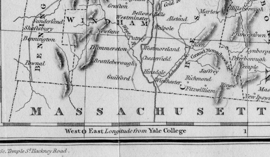
Yale College (located in New Haven, Connecticut):
Map of the Northern part of New England Compiled for Pres’t. Dwight’s Travels, By George Gillet Esq. 1821.
SOUTH AMERICA
Rio de Janeiro:
Tales from the Rare Map Cabinet by Luke A Vavra
Leave a Reply