
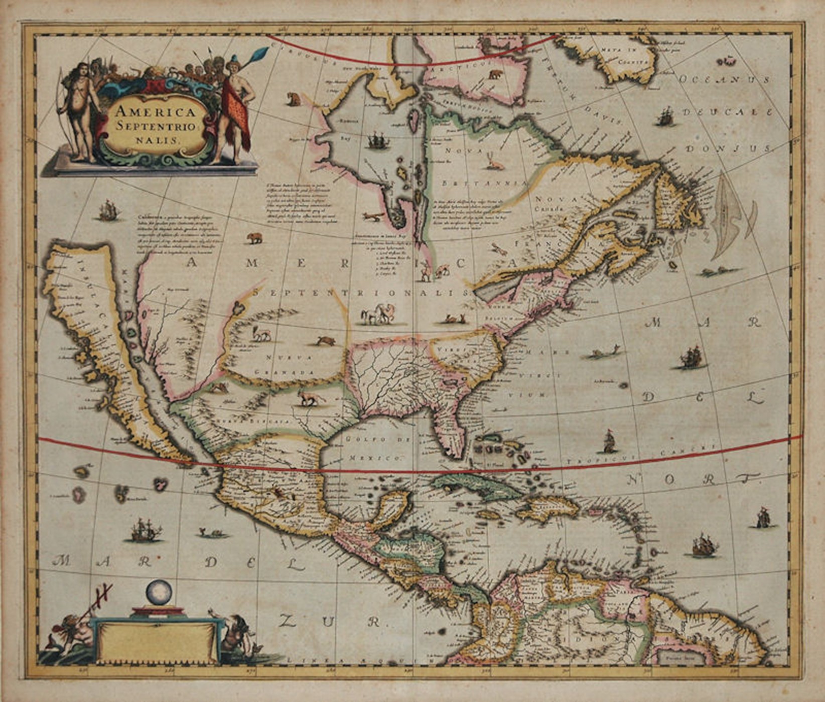
The most unusual cartographic element of this 1636 map of North America is the depiction of California as an island. This geographic error first appeared on another map in 1622, having earlier been reported by Spanish sea captain Juan de Fuca. The island is shown separated from the mainland by the “Mare Vermio” (Sea of the Worms. Sea worms, or shipworms, have long eel-shaped bodies, and are notorious for boring into and eventually destroying wood that is immersed in seawater, including such structures as wooden ships.)
Nearly every map maker adopted the island configuration; they relied on the sea-farers for the latest information about the New World so they could advertise “up-to-date” maps. The insular claim was not refuted until 1705 when a Jesuit Priest explored the area, but it took an additional hundred years before the last vestiges of California as an Island disappeared from maps.
THE MAP: NORTH AMERICA. Hondius. 1636/1639.
TITLE: America Septentrionalis.
18 3/8” h x 21 3/4″ w. Blank cartouche lower left. Engraved by Henricus Hondius (1597-1651), the brother of Jodocus Hondius who had published the rare Derivative 1, State 1 of the John Smith map. Published in Novel Atlas.Amsterdam: Hondius and Jansson. First published in 1636. This version with French text and signature “ccccc” was published 1639, 1640, 1641 and 1642.
This is a very attractively designed map showing wild life and horses, and several ships and fish at sea. Indians taken from de Bry flank the title cartouche. Only one of the Great Lakes is shown: Lac des Iroquois. Lake Champlain is incorrectly oriented. James Town, settled in 1607, is shown. There are four paragraphs of Latin text on the face of the map. This is the rare first state of this stunning map of North America that had great influence in perpetuating the theory of California as an island due to its wide distribution by this important Dutch publishing firm. The map is a careful compilation of various sources and represents the state of cartographic knowledge at the time. The same plate with Latin place names was used for a number of years while the text verso was reset in several languages.
Philip Burden shows three states:
State 1. 1636. Lacking any imprint in the cartouche lower left (as is this map).
State 2. 1641. Imprint Amstelodami, Excudit Ioannes Janssonius lower left.
State 3. c.1694.The imprint now reads Amstelodami, Penes Gerardum Valk et Petrum Schenk.
Please report about your favorite “California as an Island” map.
America Septentrionalis
At the top center is Hudson Bay, discovered in 1610 by – you guessed it, Henry Hudson. The discovery ended on a sad note. Hudson’s ship, the “Discovery”, was caught in the ice in November 1610. When the ice cleared the next spring, Hudson wanted to continue exploring, but half of the twenty-two explorers mutinied and set Hudson, his teenage son and seven crewmen adrift with some provisions and clothing in a small open boat. The abandoned group tried to keep up with the Discovery as it sailed away, but were unable to do so. They were never seen again. Of course, only one side of the story can be told. Two men who were loyal to Hudson did not survive the hazardous voyage home. Only six of the mutinous crewmen made it back to England. Mutiny charges against them were never filed.
References:
Burden, The Mapping of North America, 245, State 1.
McLaughlin, California as an Island, 6, State 1.
Tales from the Rare Map Cabinet by Luke A. Vavra
MAP HAS BEEN SOLD.
Stock Number Z12M12
Leave a Reply