
One of the most important maps of the intermountain west is a lithograph by Benjamin Louis Eulalie de Bonneville (born 1796 – died 1878) published in 1837 in Washington Irving’s extremely popular book, The Rocky Mountains: or, Scenes, Incidents, and Adventures in the far West; Digested from the Journal of Captain B.L.E. Bonneville. Irving had purchased from Bonneville the journals, notes and maps of his explorations of the America West during the years 1832 to 1835 for $1,000.
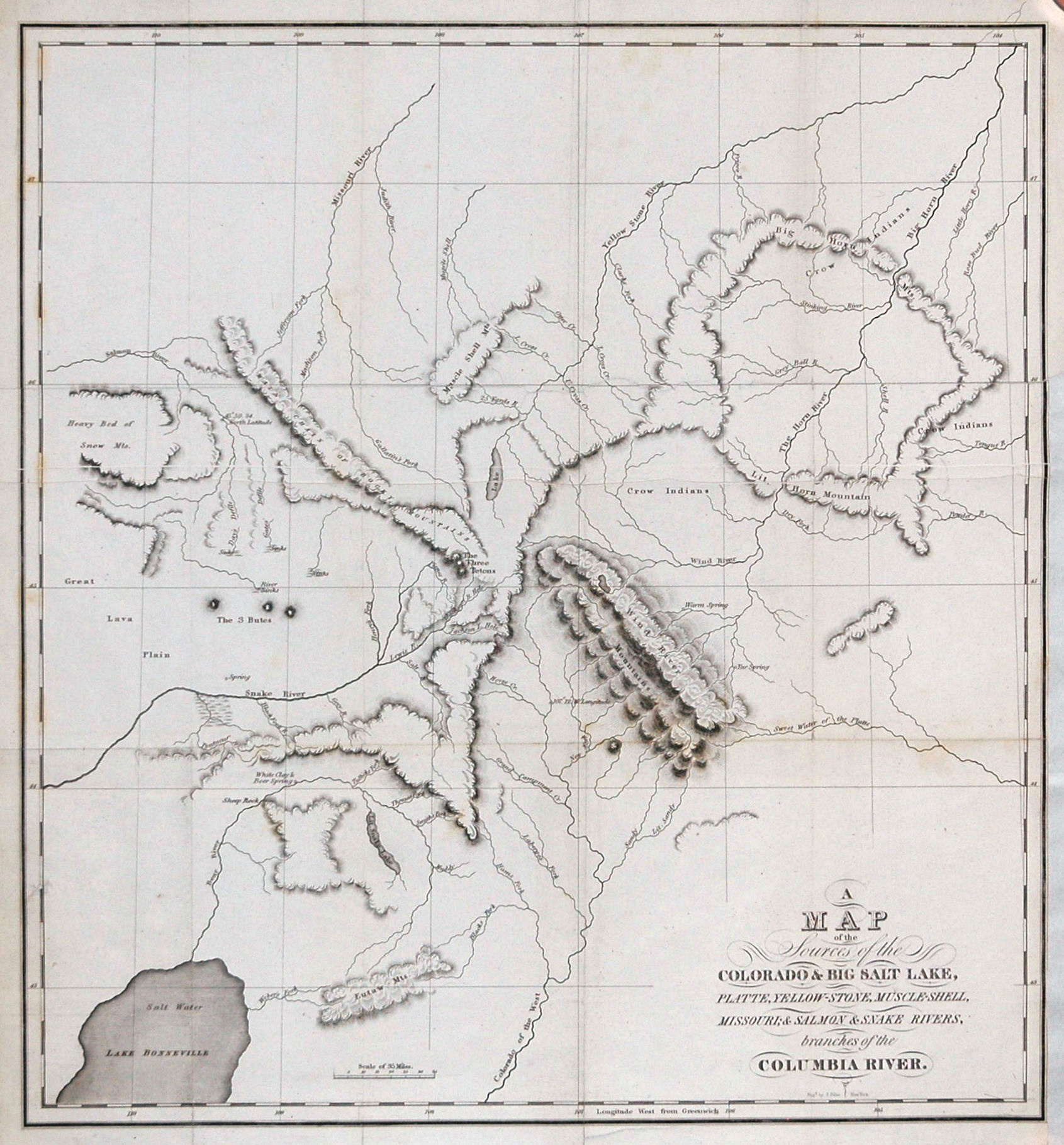
A Map of the Sources of the Colorado & Big Salt Lake, Platte, Yellow-Stone, Muscle-Shell, Missouri; & Salmon & Snake Rivers, branches of the Columbia River.
This map by Captain Bonneville covers portions of the present day of Idaho, Montana, Wyoming and Utah. It is centered on the “Wind River Mountains” and includes several named mountains including “The Three Tetons”, the “Big Horn Mts.”, and the “Lit. Horn Mountain”. Rivers include the “Missouri River” at the upper left, the “Snake River” at the left, and the “Yellow Stone River” at the upper right. At the right are the “Big Horn River” and the “Little Horn River”. The latter became known as the “Little Big Horn River”, the site of Custer’s infamous defeat in southern Montana by the Indians in 1876.
At the lower left is Lake Bonneville, usually called the Great Salt Lake. Salt Lake City, not founded until 1847, is of course, not shown. The “South Pass” is not named but would be near the center of this map.
Bonneville set out to explore the “Oregon Country”, a term referring to a large disputed region of the Pacific Northwest claimed by Great Britain, France, Russia, and Spain. The British had the strongest claim based on Vancouver’s and Mackenzie’s explorations in the 1790s.
The Oregon-Washington portion of the area was occupied by British and French Canadian fur traders from before 1810 and was dominated by the British Hudson Bay Company. From 1805 to 1806 Meriwether Lewis and William Clark explored the territory for the United States, but the US claim to the area was not as strong as the British claim.
In 1832 Bonneville and his expedition of 110 men and 20 wagons proceeded west up the Platte River in present-day Nebraska and crossed Wyoming’s South Pass of the Continental Divide. (Note: the Continental Divide extends from the Bering Sea to the Strait of Magellan and presented an enormous obstacle to wagons attempting to go west in the U.S.) This was the first-ever wagon crossing of the South Pass on the route eventually connecting central United States to the Pacific Northwest. They traveled onward, parallel to the Snake River which is shown on this map; the Snake is the largest tributary of the Columbia River. Although they did reach their intended goal of Fort Walla Walla on the Columbia, they never reached Fort Vancouver further down the Columbia, or the Willamette Valley in present-day Oregon before turning their attention to California.
Even though Bonneville and his men were not able to complete all of their goals, they were able to gather valuable information about the region and to blaze portions of a 2000-mile wagon route for the thousands of emigrants who soon followed their path to the Pacific Northwest on what became known as the Oregon Trail.
MAP HAS BEEN SOLD
Tales from the Rare Map Cabinet by Luke A Vavra
Stock Number Z13M10
Leave a Reply