
Category: Map
-
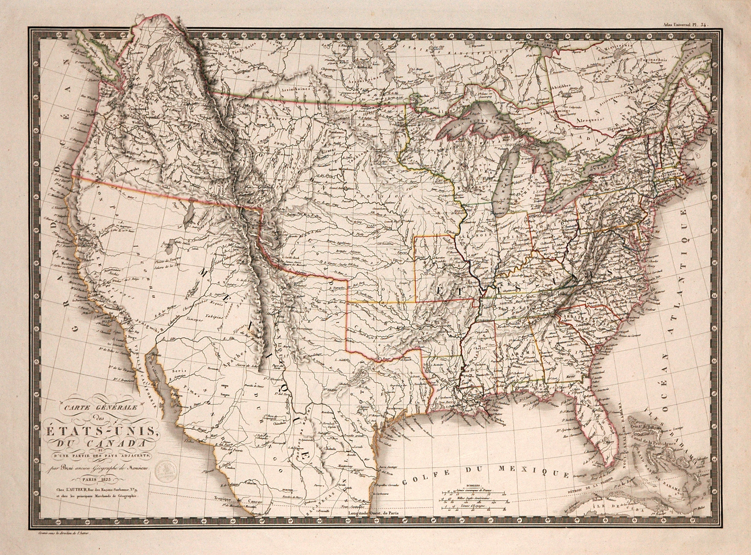
THE “OREGON COUNTRY”
THE “OREGON COUNTRY” MAP TITLE: Carte Generale des Etats Unis, Du Canada et D’Une Partie Des Pays Adjacents; par Brué, ancien Geographe du Monsieur. The focus of this 1825 map by Adrien-Hubert Brué is the “Territoire Oregon” (Oregon Territory). At the time of this map that area (extending even further North into Canada than shown)…
-

FIRST PRINTED MAP OF BARBADOS: ENGLISH COLONIALISM AND SLAVERY
FIRST PRINTED MAP OF BARBADOS: ENGLISH COLONIALISM AND SLAVERY Although occupied by North American and later South American Indians hundreds of years ago, Barbados was uninhabited when European nations began to explore the Americas. Both Spain and Portugal briefly claimed Barbados in late 16th century, but they, too, left the island uninhabited. The first English…
-
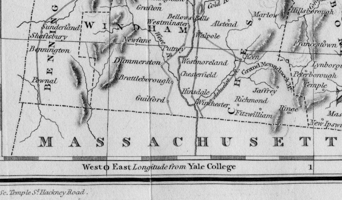
PRIME MERIDIAN AT YALE COLLEGE!!!!
PRIME MERIDIAN AT YALE COLLEGE!!!! In 1822 and 23 Timothy Dwight published his four-volume Travels in New-England and New-York covering his travels conducted over a period of several decades. It is probably the best description of New England in the early 19th century available. But that is not why I’m bringing it to your attention.…
-
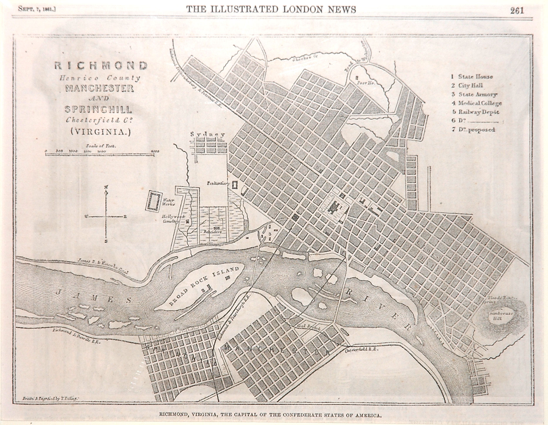
RICHMOND, VIRGINIA AND THE AMERICAN CIVIL WAR
RICHMOND, VIRGINIA AND THE AMERICAN CIVIL WAR MAP TITLE: Richmond Henrico County Manchester and Springhill Chesterfield Co. (Virginia.). Published in The Illustrated London News. 1861. This September 1861 London newspaper plan of Richmond, Virginia depicts the city just after the opening of the American Civil War. Richmond had been founded at the fall line of…
-
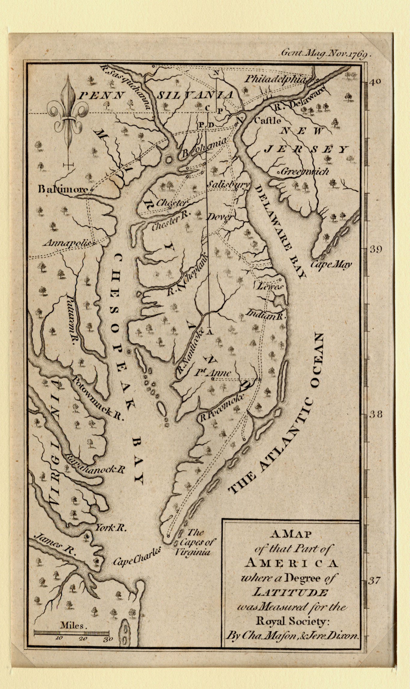
“Mortimer, how long is a Degree of Latitude?”
“Mortimer, how long is a Degree of Latitude?” Mortimer S., with arms out-stretched: “About this long. Who wants to know? “ Carl S: “Scientists, geographers, and surveyors want to know the size and shape of the Earth.” Mortimer: “Shape? I thought it was flat.” Carl: “No, it’s an oblate spheroid.” Mortimer: “I’m glad you cleared…