
Category: Map
-

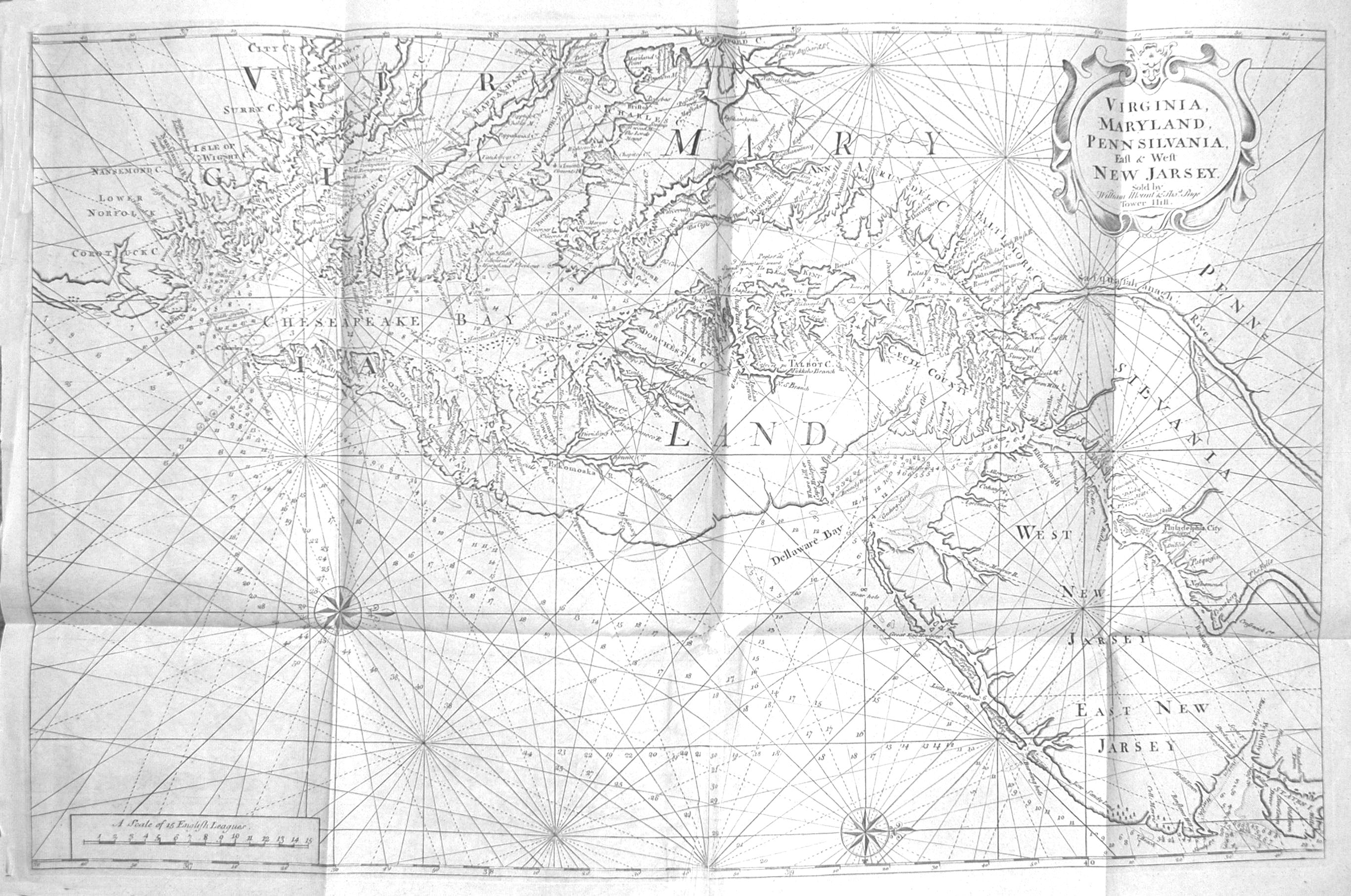
What price Allegiance!
Carte de la Virginie et du Maryland On this map, a large area in Virginia bounded on one side by the Potomac River, and, in part, by the Rappahannock River on the other, is outlined in red to get our attention. It is labeled “Limites de Lord Fairfax”. It was known as the “Northern Neck…
-

ADAM AND EVE IN THEODORE DE BRY’S GRAND VOYAGES.
This blog is intended to question the significance of the “Adam and Eve” plate in Theodore de Bry’s Part I (Virginia) of his Grand Voyages. In Par I and again in Part III, Theodore de Bry placed an engraving of Adam and Eve ahead of the engravings of the Algonquians of eastern North Carolina. Why…
-

FIRST PRINTED PLAN OF WASHINGTON, DC
Plan of the City of Washington This Plan of the City of Washington dates from March 1792 and is the first printed plan of the city. It is based on Major Andrew Ellicott’s version of Pierre Charles L’Enfant’s plan for the new capital city. L’Enfant, a French architect and military engineer who had fought for…
-
DOES EDITION REALLY MATTER?
BOOKS: If you collect books, you already know the answer. First editions of books are, almost universally, much more valuable than later editions – occasionally reaching tens of thousand dollars higher for “best sellers”. A first edition a book is considered more valuable simply due the significance of s being the very first appearance of…
-
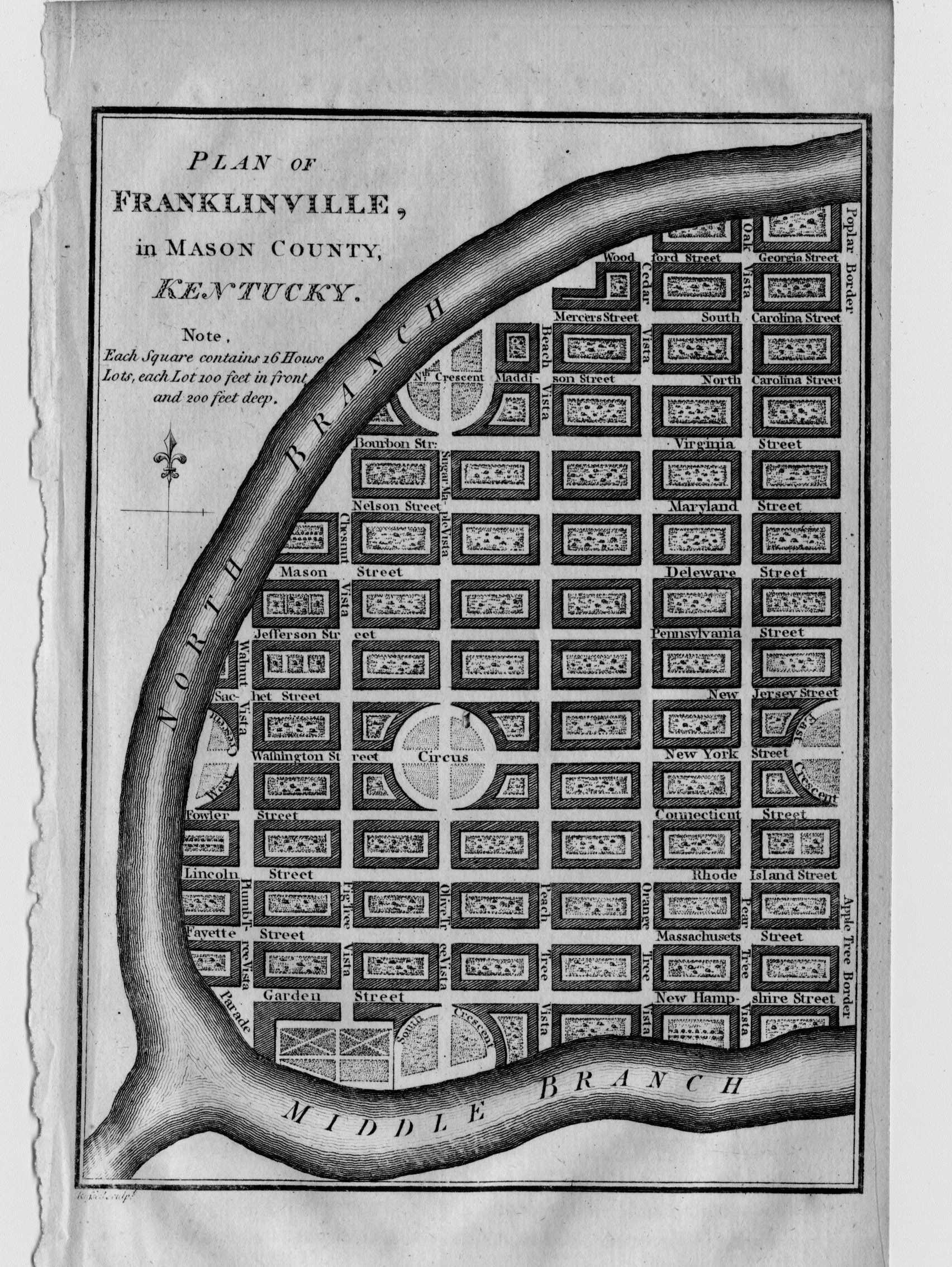
TWO KENTUCKY TOWNS THAT NEVER WERE
Plan of Lystra, in Nelson County, Kentucky. Plan of Franklinville, in Mason County, Kentucky. Two towns, Lystra and Franklinville, Kentucky were separately mapped and appear on at least one antique map of Kentucky. Where are they now? Plans for these two towns by John Russell are found in William Winterbotham’s four-volume history of North America…
-
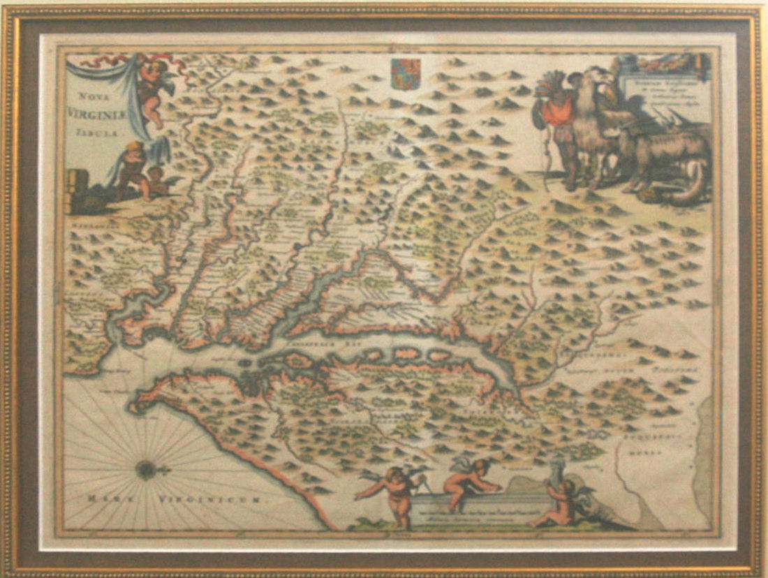
WHAT? LLAMAS IN COLONIAL VIRGINIA?
On the upper right corner of his 1671 map of Virginia, Nova Virginiae Tabula, the engraver Jacob van Meurs included a map legend for three elements depicted only as symbols on his map. That’s not unusual, you say. Well, what is unusual is the image that surrounds the legend: an Indian, an African American, a…
-
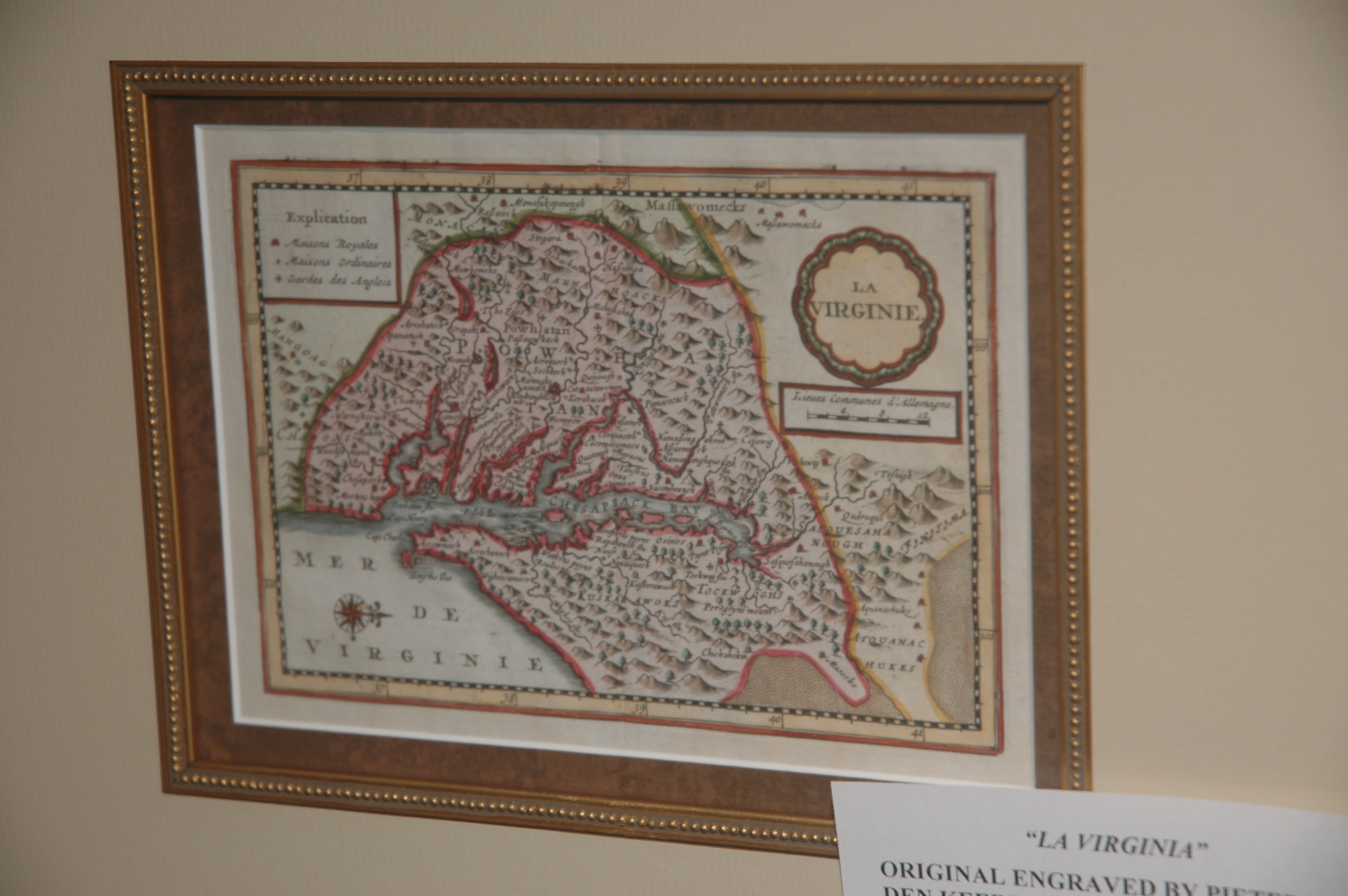
THE RAREST JOHN SMITH’ DERIVATIVE
In an earlier blog about maps derived from the John Smith’s map Virginia, I wrote that I would later describe the rarest map of that genre. In 1628 Peter van den Keere (1571-c1646) engraved a small map of Virginia for what was called a minor (small format) atlas. The map is shown below. The geography…
-
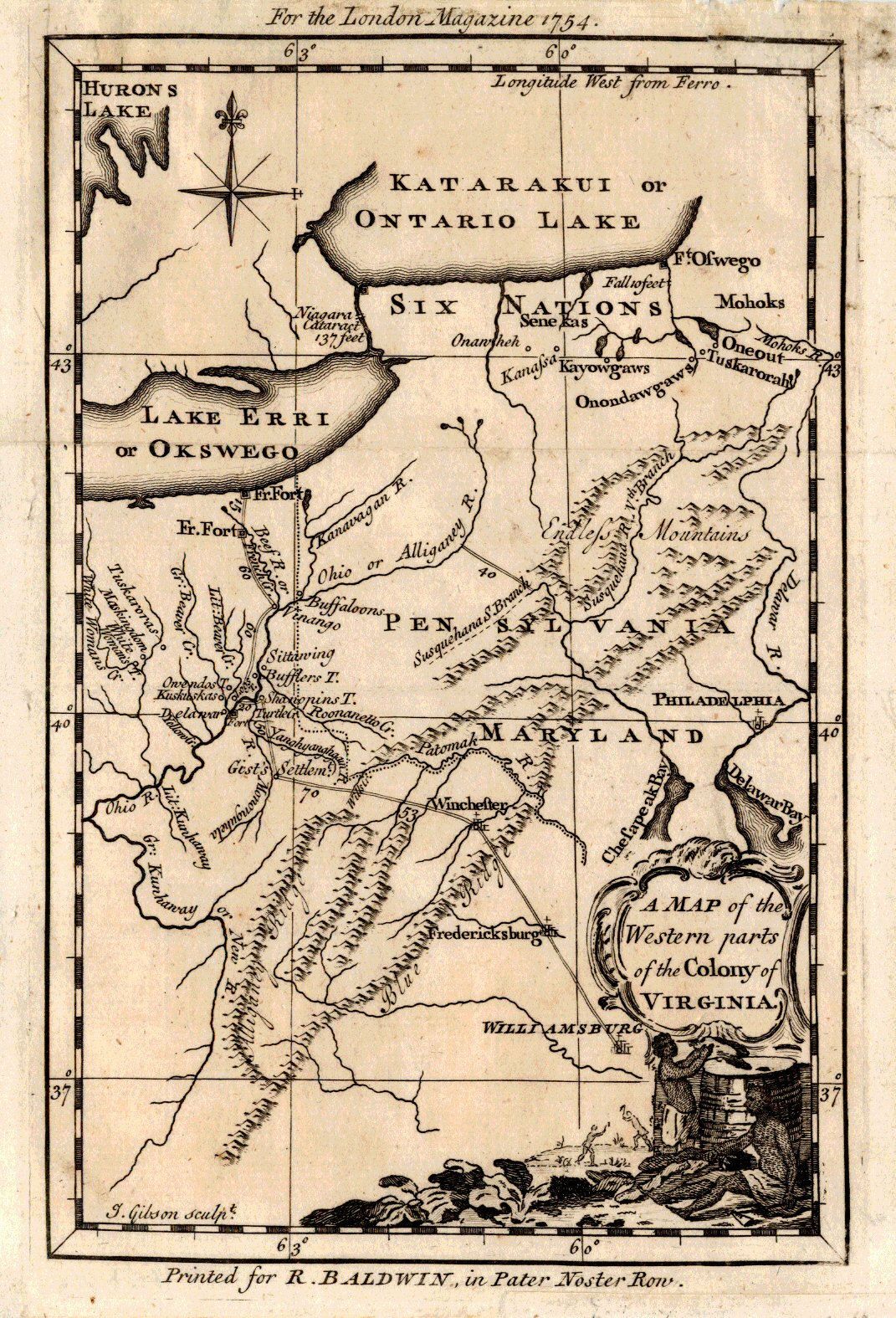
TAKE A LETTER, GEORGE.
A Map of the Western parts of the Colony of Virginia. In late October, 1753, twenty-one year-old Major George Washington was ordered by Robert Dinwiddie, Lieutenant-Governor of the Colony of Virginia, to take a letter from Dinwiddie to the commander of French forces in the Ohio Country. That letter unabashedly requested the “peaceful departure” of…
-
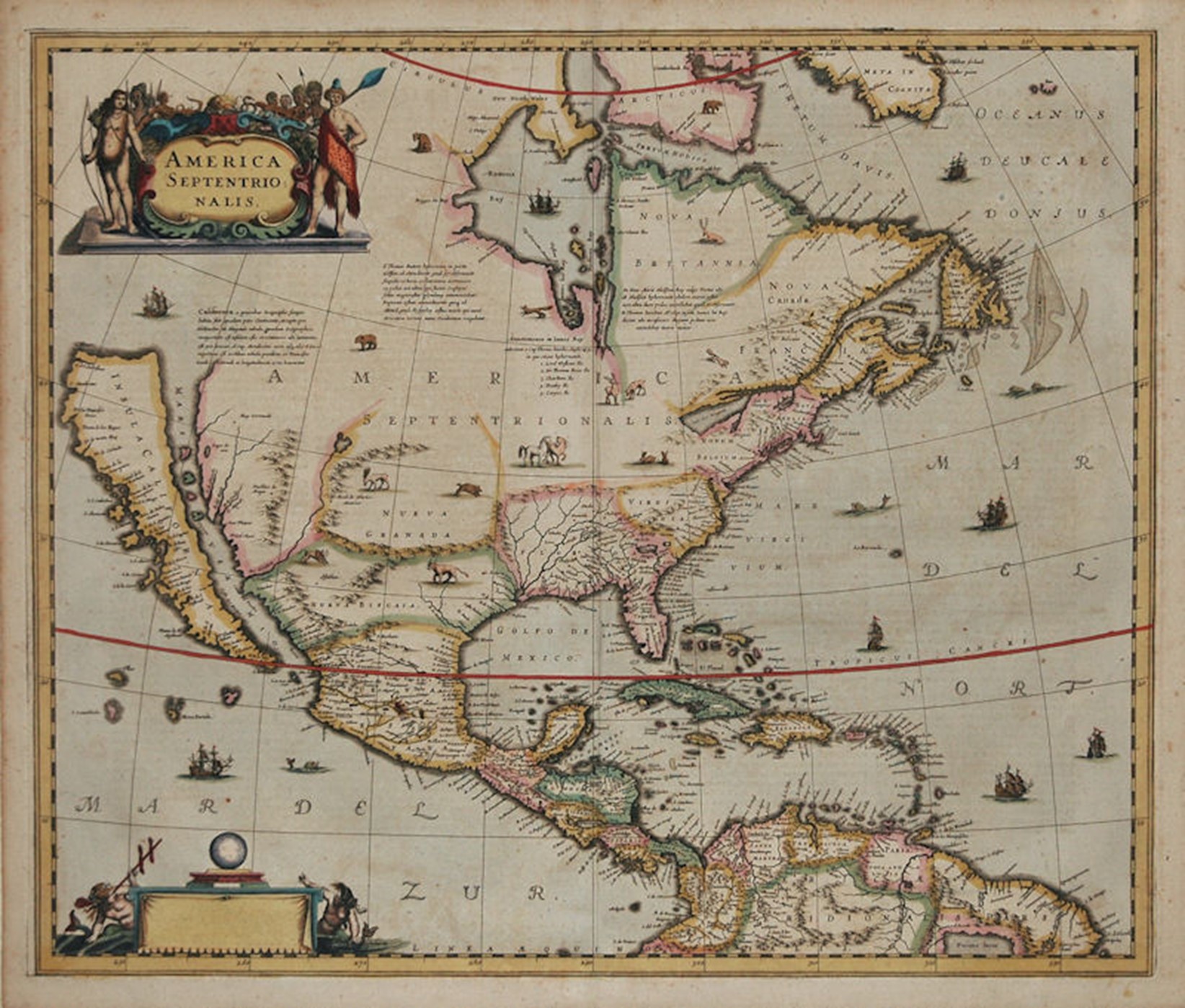
CALIFORNIA AS AN ISLAND
The most unusual cartographic element of this 1636 map of North America is the depiction of California as an island. This geographic error first appeared on another map in 1622, having earlier been reported by Spanish sea captain Juan de Fuca. The island is shown separated from the mainland by the “Mare Vermio” (Sea of…
-

JOHN SMITH AND HIS MAP OF VIRGINIA
JOHN SMITH AND HIS MAP OF VIRGINIA One of the most significant historical pieces from the colonial period is map simply titled “Virginia”. It was a magnificent map, full of information about the terrain and Indian tribes and embellished with two images captured by John White in his trip to nearby Roanoke Island in 1597.…