
Author: ute239
-

The 1819 Edition of John Smith’s Map of Virginia
In 1612 John Smith’s map, simply titled Virginia, appeared on the market in London and was an immediate success. Shown below is an image of the imprint of Smith’s map with the engraver’s name, William Hole. Detail from Smith’s “Virginia” Over the next century several publishers brought out their modified versions of Smith’s map. Some…
-
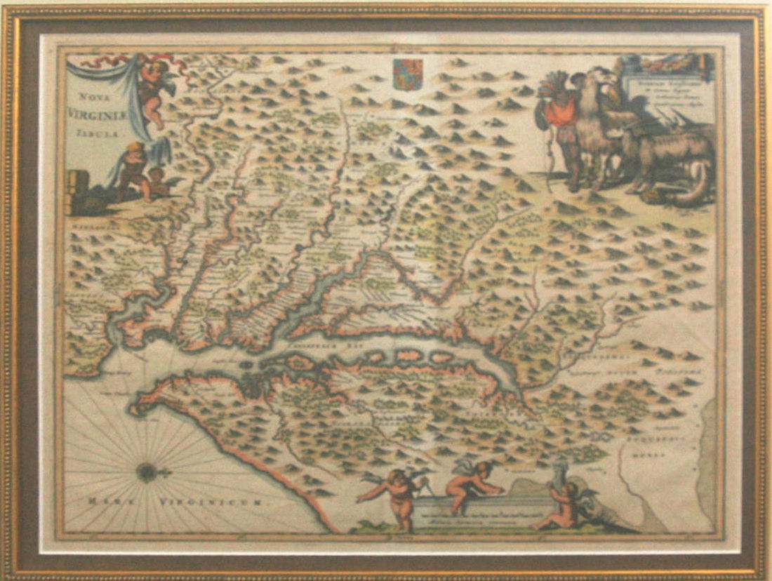
WHAT? LLAMAS IN COLONIAL VIRGINIA?
On the upper right corner of his 1671 map of Virginia, Nova Virginiae Tabula, the engraver Jacob van Meurs included a map legend for three elements depicted only as symbols on his map. That’s not unusual, you say. Well, what is unusual is the image that surrounds the legend: an Indian, an African American, a…
-
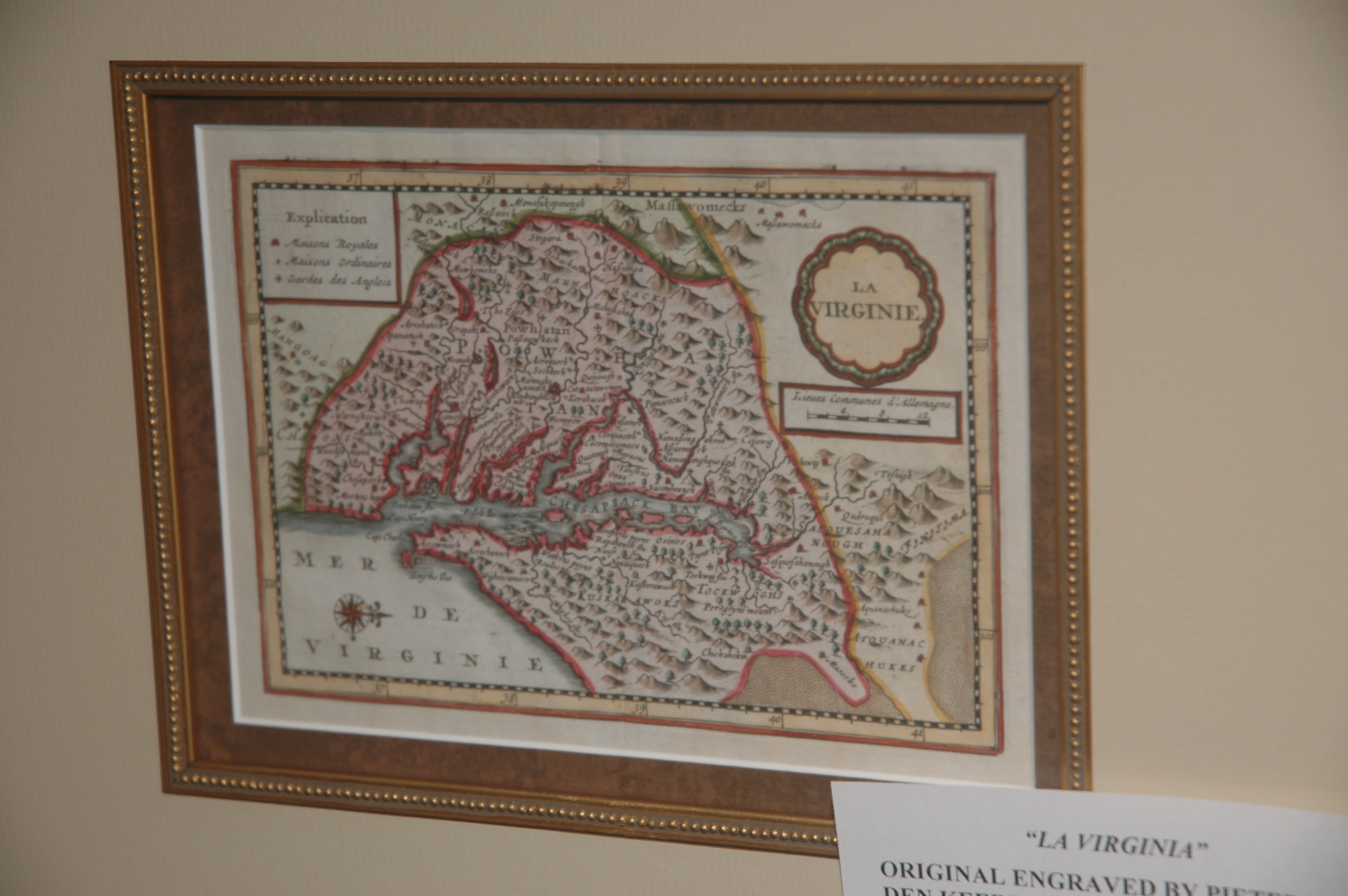
THE RAREST JOHN SMITH’ DERIVATIVE
In an earlier blog about maps derived from the John Smith’s map Virginia, I wrote that I would later describe the rarest map of that genre. In 1628 Peter van den Keere (1571-c1646) engraved a small map of Virginia for what was called a minor (small format) atlas. The map is shown below. The geography…
-
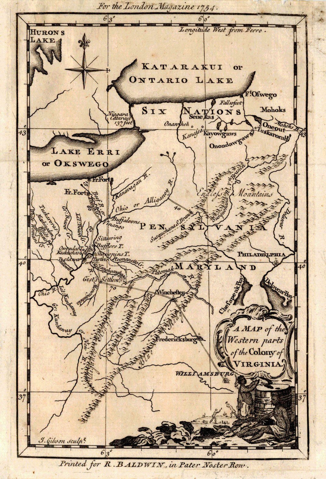
TAKE A LETTER, GEORGE.
A Map of the Western parts of the Colony of Virginia. In late October, 1753, twenty-one year-old Major George Washington was ordered by Robert Dinwiddie, Lieutenant-Governor of the Colony of Virginia, to take a letter from Dinwiddie to the commander of French forces in the Ohio Country. That letter unabashedly requested the “peaceful departure” of…
-
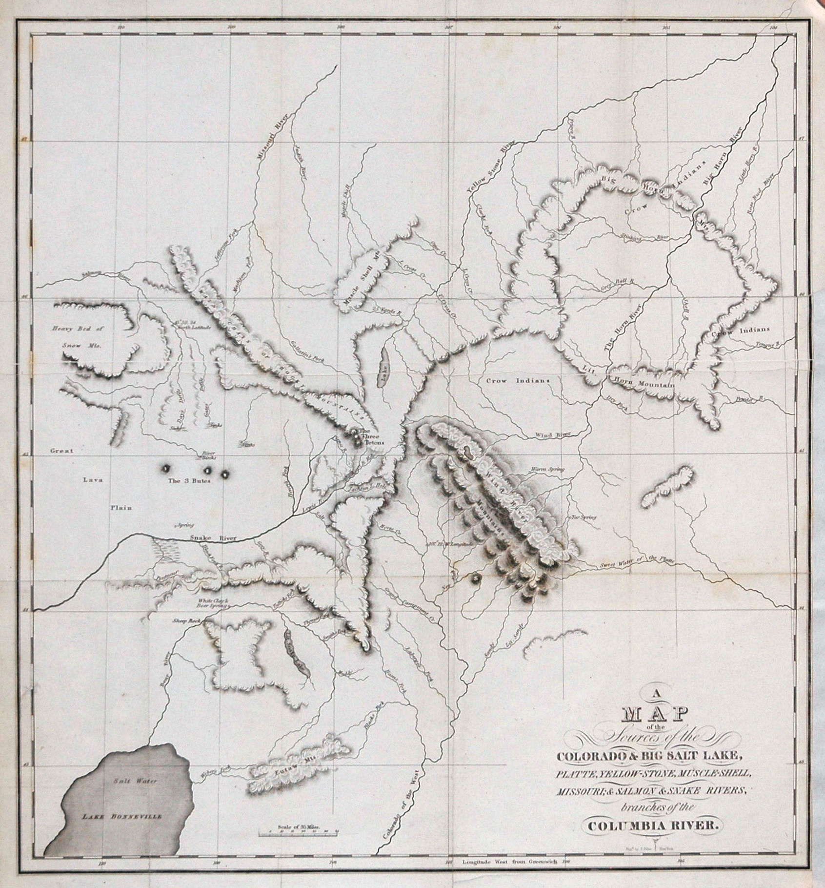
BONNEVILLE’S MAP OF THE INTERMOUNTAIN WEST
One of the most important maps of the intermountain west is a lithograph by Benjamin Louis Eulalie de Bonneville (born 1796 – died 1878) published in 1837 in Washington Irving’s extremely popular book, The Rocky Mountains: or, Scenes, Incidents, and Adventures in the far West; Digested from the Journal of Captain B.L.E. Bonneville. Irving had…
-
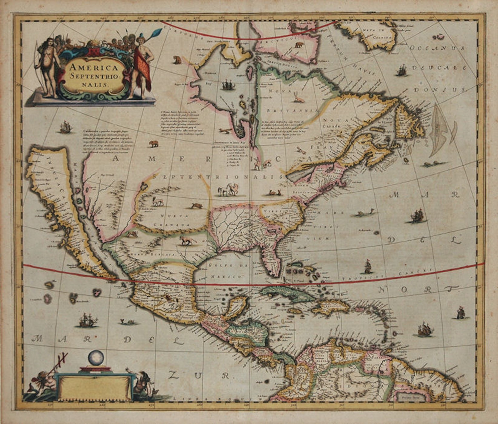
CALIFORNIA AS AN ISLAND
The most unusual cartographic element of this 1636 map of North America is the depiction of California as an island. This geographic error first appeared on another map in 1622, having earlier been reported by Spanish sea captain Juan de Fuca. The island is shown separated from the mainland by the “Mare Vermio” (Sea of…
-

JOHN SMITH AND HIS MAP OF VIRGINIA
JOHN SMITH AND HIS MAP OF VIRGINIA One of the most significant historical pieces from the colonial period is map simply titled “Virginia”. It was a magnificent map, full of information about the terrain and Indian tribes and embellished with two images captured by John White in his trip to nearby Roanoke Island in 1597.…
-
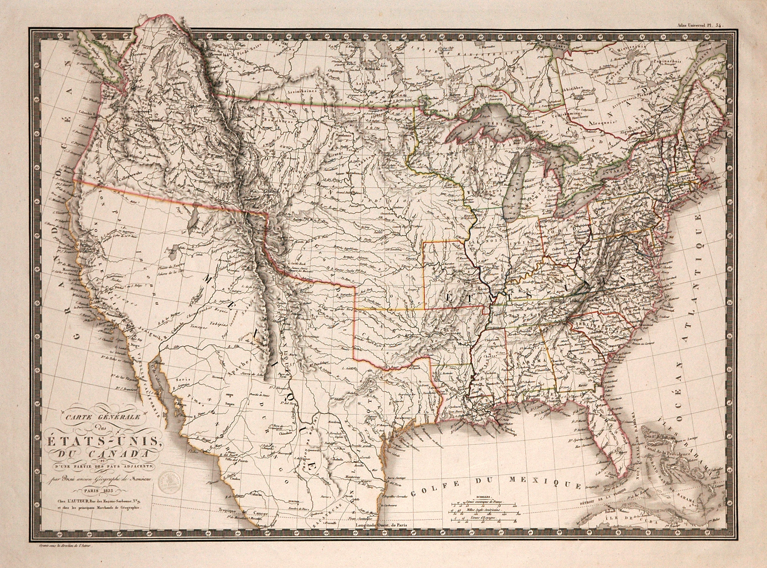
THE “OREGON COUNTRY”
THE “OREGON COUNTRY” MAP TITLE: Carte Generale des Etats Unis, Du Canada et D’Une Partie Des Pays Adjacents; par Brué, ancien Geographe du Monsieur. The focus of this 1825 map by Adrien-Hubert Brué is the “Territoire Oregon” (Oregon Territory). At the time of this map that area (extending even further North into Canada than shown)…
-

FIRST PRINTED MAP OF BARBADOS: ENGLISH COLONIALISM AND SLAVERY
FIRST PRINTED MAP OF BARBADOS: ENGLISH COLONIALISM AND SLAVERY Although occupied by North American and later South American Indians hundreds of years ago, Barbados was uninhabited when European nations began to explore the Americas. Both Spain and Portugal briefly claimed Barbados in late 16th century, but they, too, left the island uninhabited. The first English…
-
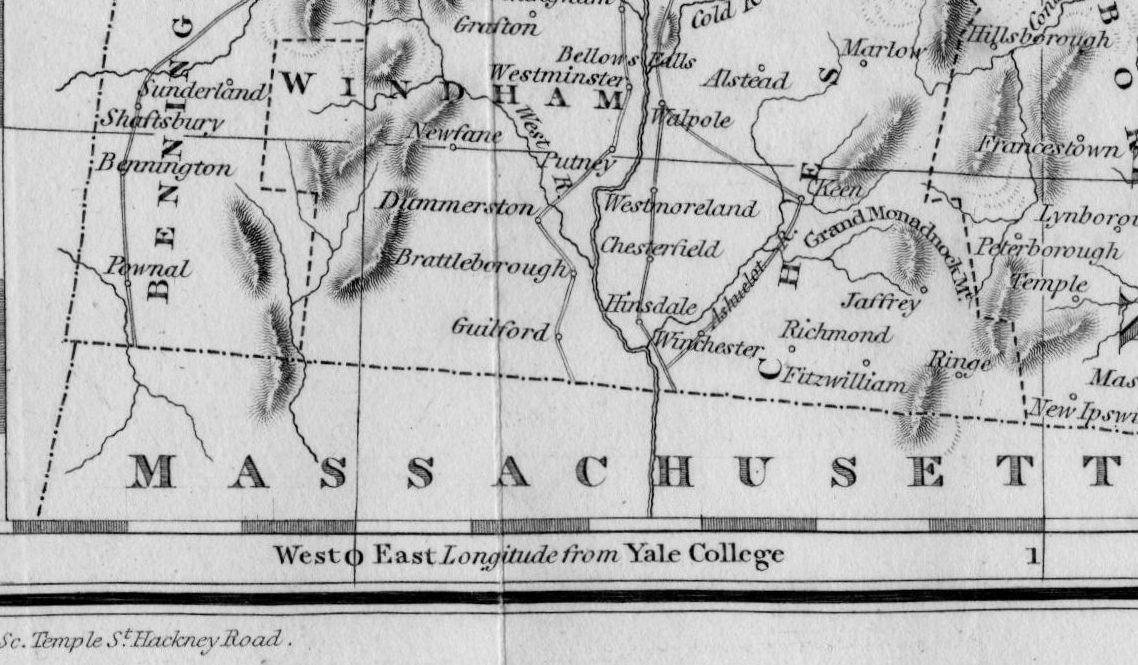
PRIME MERIDIAN AT YALE COLLEGE!!!!
PRIME MERIDIAN AT YALE COLLEGE!!!! In 1822 and 23 Timothy Dwight published his four-volume Travels in New-England and New-York covering his travels conducted over a period of several decades. It is probably the best description of New England in the early 19th century available. But that is not why I’m bringing it to your attention.…